Skip to content.
|
Skip to navigation
Personal tools
Log in
Register
Search Site
only in current section
Advanced Search…
Sections
Human Services Plan
Waterloo Estate Stage 1
Waterloo Metro Quarter
Elizabeth St SSP
Explorer Street
Eveleigh Heritage
RNE - Paint Shop
RNE - Clothing Store
Redfern Station
Find a Service
REDWatch Facebook
Navigation
Home
About REDWatch
Our Community
Government Sites Plans & Activities
Redfern Waterloo Maps
Built Environment Plan Phase 1 - The State Significant Sites
Built Environment Plan Phase 2 - Public Housing Estates
Human Services Plans
Employment & Enterprise Plan
Eveleigh Rail Heritage
RWA Operational Archive
DoP Major Projects
SMDA BEP2 & Urban Renewal Studies
Rail Corridor Expansion
Waterloo Public Housing & Metro Station Redevelopment
Elizabeith Street SSDA
Central-Eveleigh Sydney Inovation and Technology Precinct
Explorer Street Eveleigh Renewal
Other Government Involvement in RW
Other RW Issues
Have Your Say
Consultation Links
Past Events
Event Posters
2004-2012 Statements
Log in
Login Name
Password
Cookies are not enabled. You must enable cookies before you can log in.
Forgot your password?
You are here:
Home
/
Government Sites Plans & Activities
/
Redfern Waterloo Maps
/
RED Traffic Impacts
Info
RED Traffic Impacts
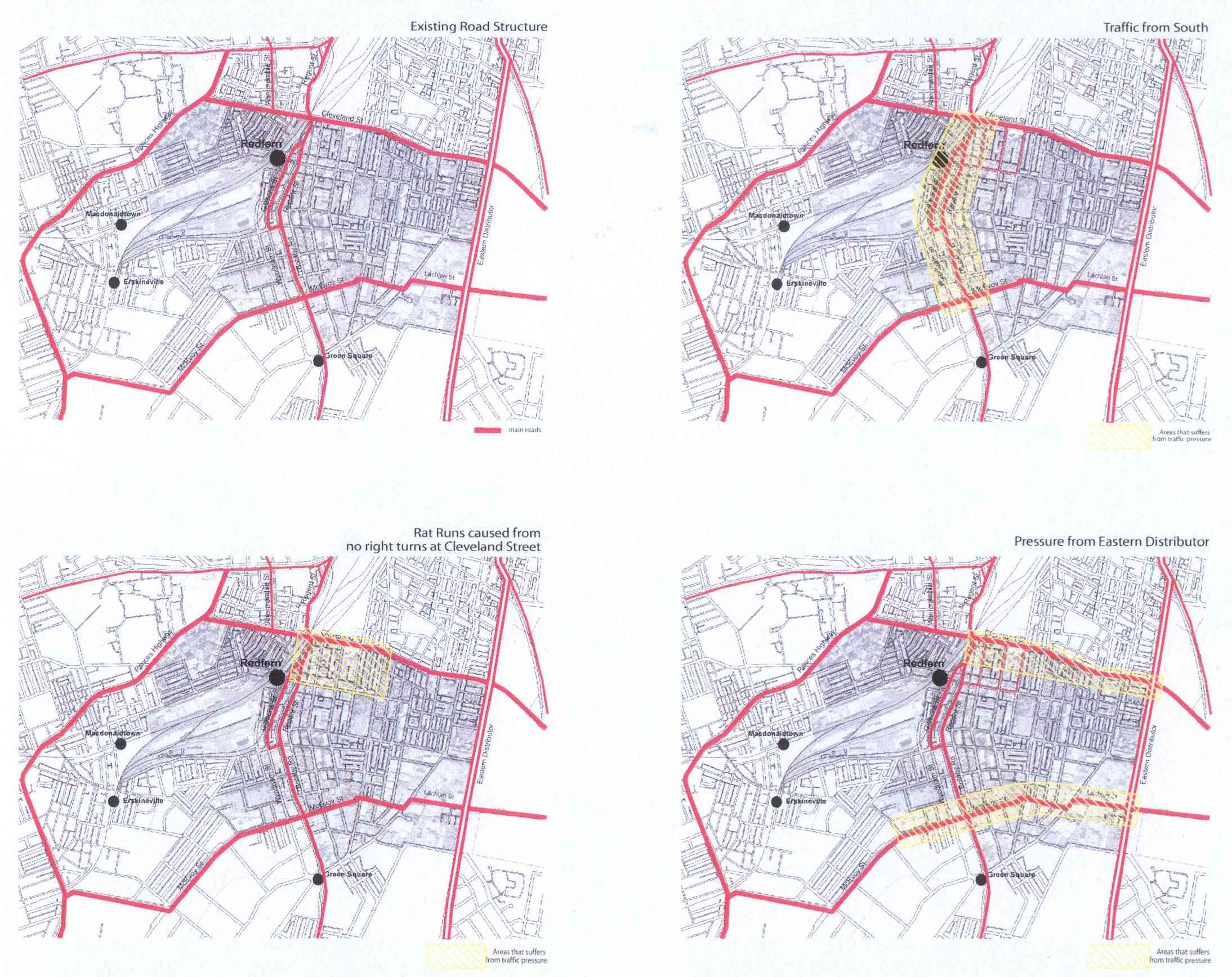
These maps show the regional traffic impacts on Redfern Waterloo identified by the RED Strategy Consultants. Source Slide 8 RED Strategy Consultation Overheads 25 June 2003. File size is 330 Kb.
— JPEG image, 330 kB (338012 bytes)
Powered by Plone & Python
Accessibility
Contact