Land Ownership around The Block
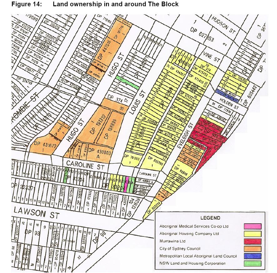
This map shows land ownership around The Block in Redfern in early 2004. This map is Figure 14 "Land ownership in and around The Block" from the NSW Government Submission for the Inquiry into Redfern and Waterloo 30 April 2004. File size is 229 Kb.
 —
JPEG image,
229 kB (234984 bytes)
—
JPEG image,
229 kB (234984 bytes)
