Road Structure
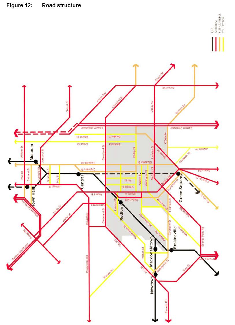
This map shows the road structure for the RED area. The RED area is bordered on two sides by arterial roads and has a twin pair arterial road running through the Redfern Town centre.This map is Figure 12 "Road Structure" from the NSW Government Submission for the Inquiry into Redfern and Waterloo 30 April 2004. File size is 87 Kb.
 —
JPEG image,
87 kB (89650 bytes)
—
JPEG image,
87 kB (89650 bytes)
