National Trust Register Redfern Waterloo
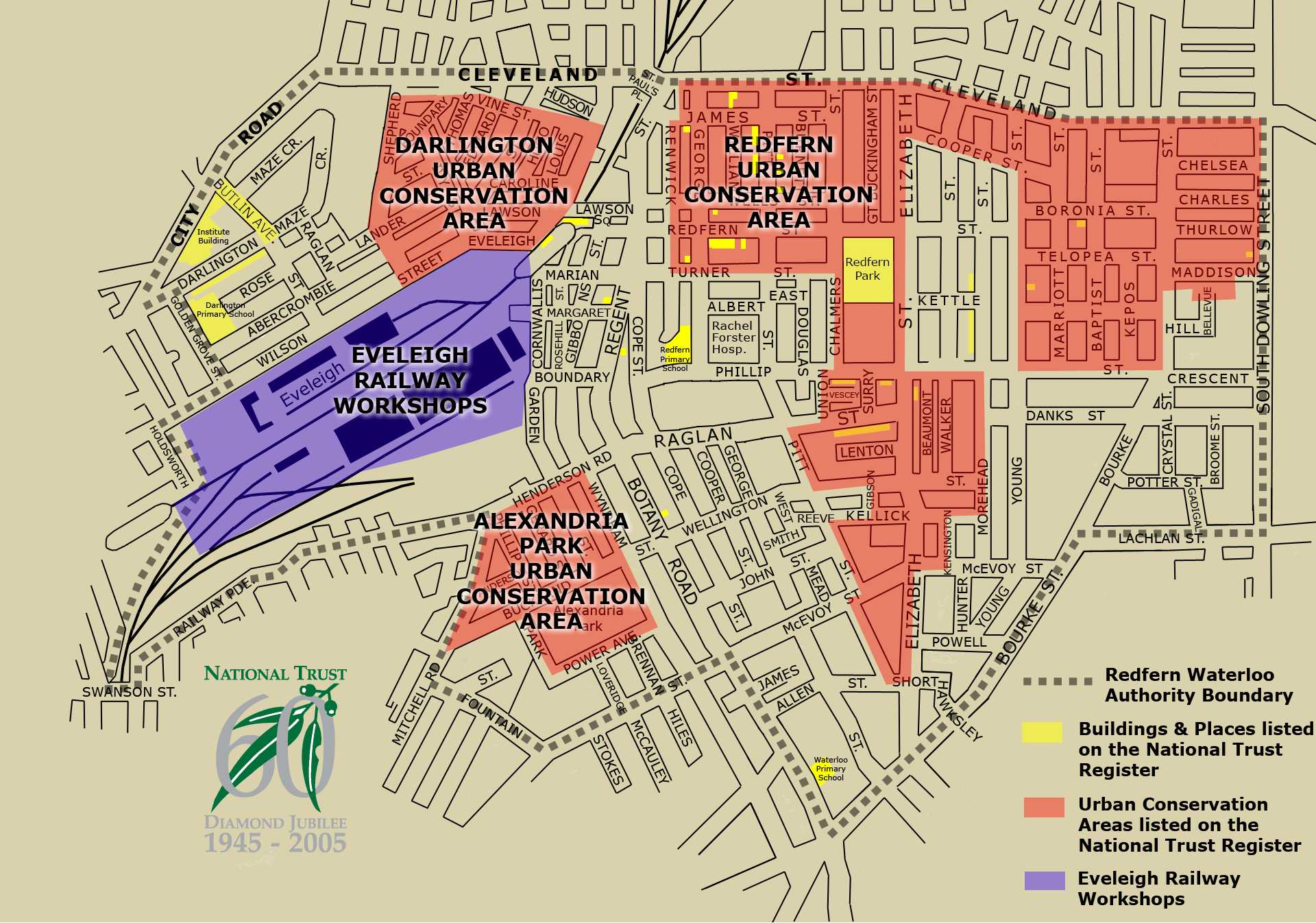
This map was produced by the National Trust at the time of the RWA anouncement. It shows the RED Strategy boundaries rather than the subsequently accepted RWA boundaries. The Statement issued with the map was also based on some of Alexandria being involved. In the statement the traust said
"In the Redfern/Waterloo area there are four conservation areas that have been classified by the Trust and entered on the National Trust Register. Forty three percent of the total area is classified by the Trust with an expectation that it will be conserved for future generations.
"Two hundred and five individual buildings and parks are also entered on the National Trust Register including Redfern, Waterloo and Darlington Primary Schools and Redfern Railway Station considered by the Trust to be unique among the state’s train stations and dating back to the 1870s."
The full statement can be seen at http://www.nsw.nationaltrust.org.au/redfernwaterloo.html. The file is 310 Kb.
 —
JPEG image,
308 kB (316000 bytes)
—
JPEG image,
308 kB (316000 bytes)
